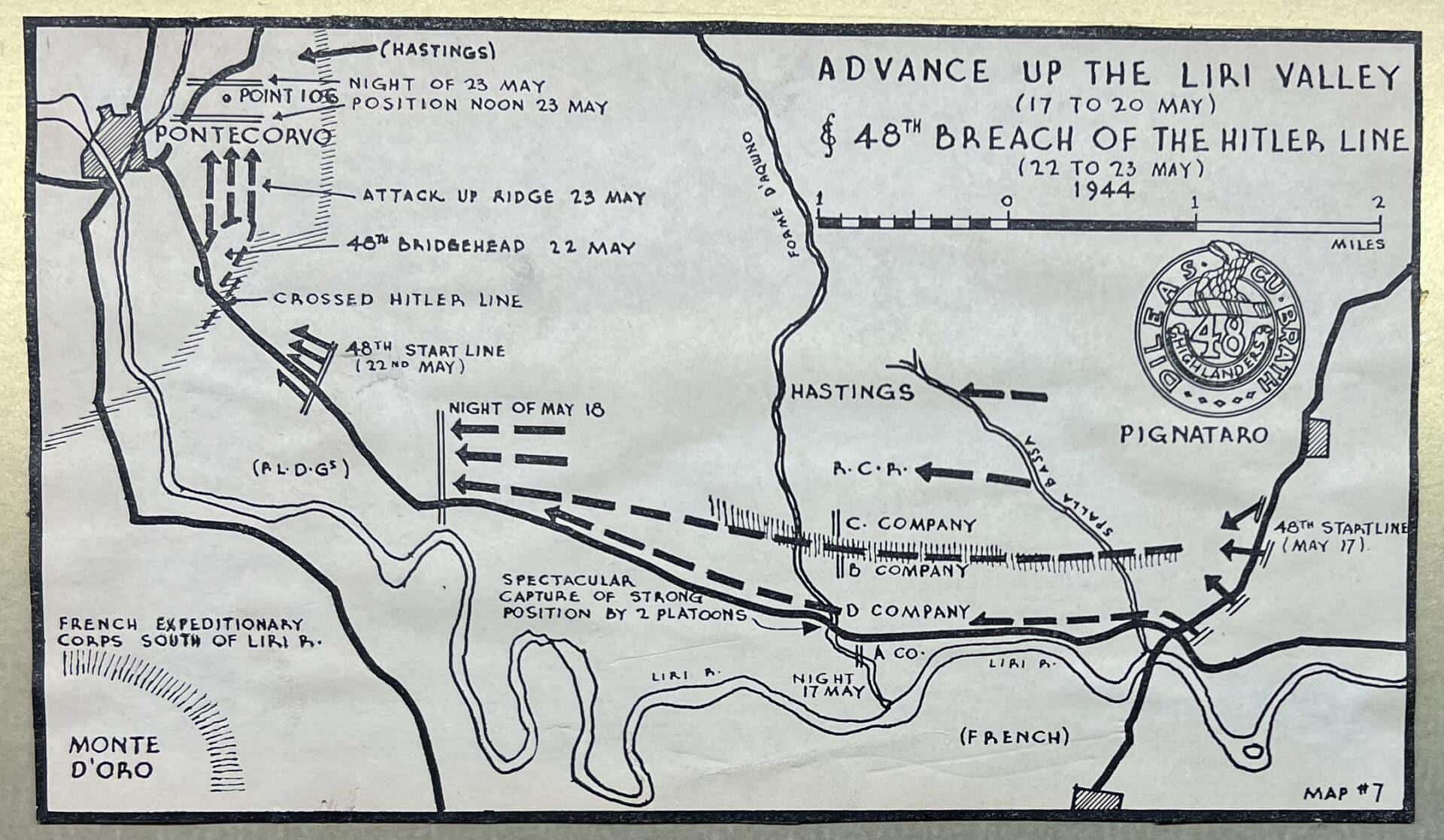
A 4.75 inch by 8.25 inch map outlining the advance by the 48th Highlanders up the Liri valley and their subsequent breaching of the Hitler Line. These maps were hand drawn by Brigadier Eric Haldenby for the 48th Highlanders’ Second War history Dileas by Kim Beattie. The 48th Highlanders, after assaults by other brigades, attacked alone, unsupported by any advanced artillery bombardment, and breached the Hitler Line, fighting two full days within the Line resulting in a beachhead through which the rest of the 1st Brigade and other units could continue to the final defeat of the Hitler Line.
The Hitler Line
“The Hitler Line has been vaunted to the world as an impregnable position,” said Lt.-Gen. Sir Oliver Leese, in a dispatch direct to Major-General Chris Vokes.
The Hitler Line is manned, said Intelligence, with 8,300 Germans between Monte Cassino, its eastern mountain pivot, and the Liri River. But it was fixed fortifications, artillery, mortars, machine-guns and anti-tank weapons, especially Teller and box mines, and not men in large numbers which constituted the blockading strength of the Hitler Line.
Excerpts From
Dileas: A History of the 48th Highlanders of Canada 1929–1956
Kim Beattie