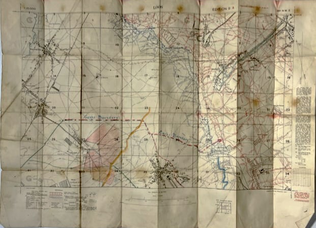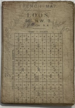
A 4.5 inch by 6.75 inch (when folded) cotton rag map coated with waterproofing of Loos, 36º N W, Edition 9. A, Scale 1: 30,000.
A Trench map shows trenches dug for use in war. This article refers mainly to those produced by the British during the Great War, 1914–1918 although other participants made or used them..
For much of the Great War, trench warfare was almost static, giving rise to the need for large scale maps for attack, defence and artillery use. Initially, British trench maps showed the German trench systems in detail, but only the British Front line. Later in the war, more of the British trenches were shown. The only British maps that showed full detail of both sides were the secret editions, usually marked “Not to be taken beyond Brigade HQ” for fear of their falling into enemy hands.