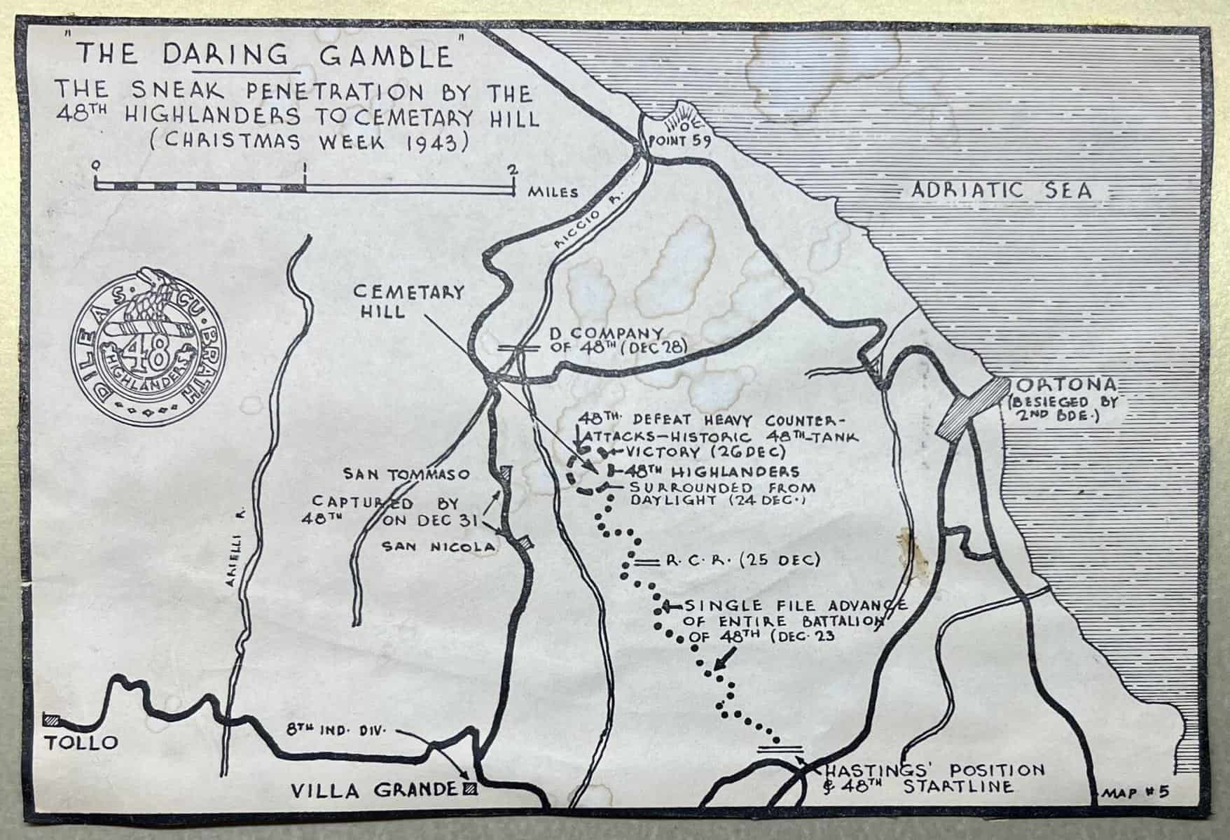
A 8 inch by 5.5 inch map outlining the Ortona battle in which the 48th Highlanders during the night of 23/24 December, 1943, penetrated 1200 meters behind the German lines, undetected, and set up an all-round defence. Their goal was to outflank the town of Ortona, threatening the only road in or out of the town available to the German defenders. The Highlanders fought alone, successfully repelling German counterattacks for three days. The Germans withdrew on 27 December from the Highlander’s position and began their abandonment of Ortona. These maps were hand drawn by Brigadier Eric Haldenby for the 48th Highlanders’ Second War history Dileas by Kim Beattie. Casualties for the German exceeded 120 and for the Highlanders only 8. When Padre East buried the soldiers of both sides he named the location “Cemetery Hill”.
Ortona (Cemetery Hill)
The Highlanders only survived the first moments of the attack by this display of controlled fire. They broke up the Germans at some points, and then the fight became so fierce that victory went to the Highlanders only because of their sheer defiance. They should have been beaten and overrun by all the laws of odds and tactics, but they were not.
Excerpts From
Dileas: A History of the 48th Highlanders of Canada 1929–1956
Kim Beattie