Trench and Area Maps – Col. JCD d’Esterre – 1917
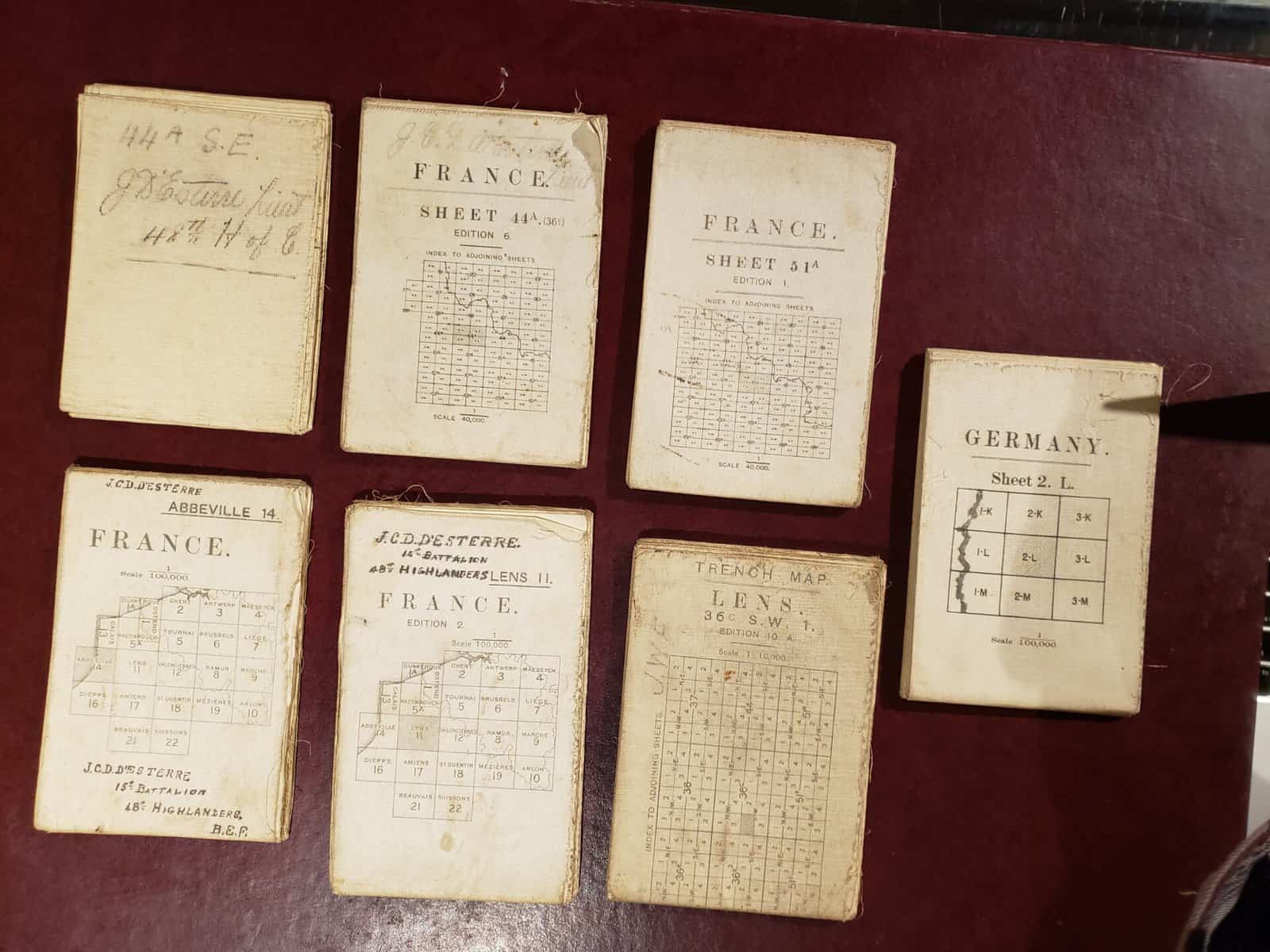
Seven folded maps on linen – fibre paper. Each is 32″ x 23″. Field survey map of trenches around Dourges France on Sept 26, 1918 Field survey map around Lens France with trench markings Field survey map of Valenciennes France Large scale field survey map of Lens France Topographical map of Abbeville France 1915 Ordnance […]
Waterproofed Map of Lille, France
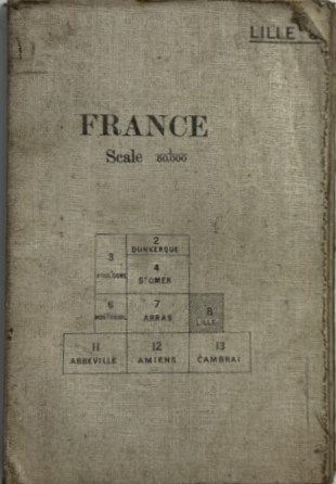
A 4.5 inch by 6.75 inch (when folded) waterproofed map of Lille France, sale 1/80000. Lille is the capital of the Hauts-de-France region in northern France, near the border with Belgium. A cultural hub and bustling university city today, it was once an important merchant center of French Flanders, and many Flemish influences remain. The […]
Loos Trench Map 36º NW3
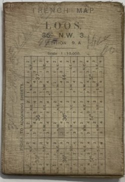
A 4.5 inch by 6.75 inch (when folded) cotton rag map coated with waterproofing of Loos, 36º N W, Edition 9. A, Scale 1: 30,000. A Trench map shows trenches dug for use in war. This article refers mainly to those produced by the British during the Great War, 1914–1918 although other participants made or […]
Locations of TAC 21 Army Group HQ, 1944-45
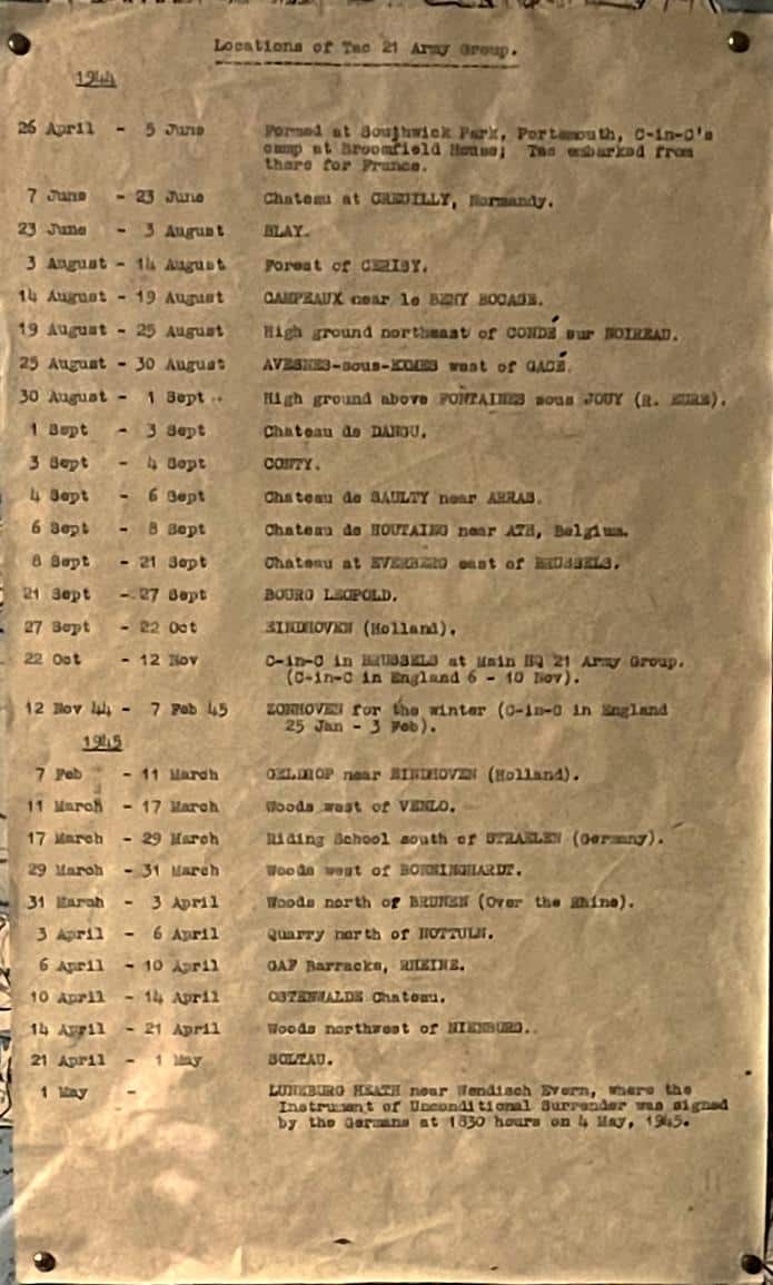
Foolscap page, typescript. Twenty-eight (28) dates and locations are listed. From England to D-Day landing sites to Luneburg, Germany. Conforms with the dates and locations inscribed on the Map of Northwest Europe, with other items of Field Marshal Sir Bernard Montgomery’s HQ.
Map of Northwest Europe and England – TAC 21 Army Group HQ Route

Coloured map with dated locations of TAC 21 Army Group HQ indicated in alternating black and white ink of route leading from Normandy D-Day landing sites to Luneburg, Germany. TAC 21 HQ was Field Marshall Bernard Law Montgomery’s HQ. Luneburg Heath in near Hamburg in NE part of the state of Lower Saxony in northern […]
Ypres general area map
Western Front 1918
map with photo of presentation 1973
Pachino 1943 Landing Map
army map of Pachino. Sicily and area, framed in black frame with glass cover. Typed heading added “Pachino where the 48th Highlanders of Canada landed in Sicily, July 10th 1944”: Note date should be 1943